Resources
data, code samples, logs...
Here you can find resources (data, code examples, logs, etc.) for Robotour 2010 contest …
Map Format
The map is no longer provided in RNDF format as it was previous years. Instead
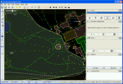
JOSM (Java OpenStreetMap
Editor) format will be supported. OSM server
will be also used to carry all actualizations including updates
from competitors. We expect that besides three park candidates for Robotour
2010 there will be also many „test maps” of surrounding park areas near the
team home bases. This will include maps of Stromovka/Praha and Lužánky/Brno from
previous years of contest.
In short, JOSM is XML file containing three types of records:
- node — point with attributes id, lat a lon
- way — list of node references coded via <nd ref="node id">
- relation — relations, used for example for description of buildings
Every record has also attributes user/uid and timestamp, i.e. by
who and when was given element edited. The number in attribute changeset
then corresponds to map revision. Interesting information could be also found
in <tag> (for example width of given way etc.).
Node Example
<node id="242744133" lat="50.1057063" lon="14.42758" version="2"
  changeset="772392" user="Petr" uid="17615" visible="true"
  timestamp="2009-01-11T13:03:48Z">
 <tag k="created_by" v="JOSM"/>
</node>
Way Example
<way id="33898726" visible="true" timestamp="2009-05-01T20:55:40Z"
    version="1" changeset="1041618" user="Petr" uid="17615">
  <nd ref="388382600"/>
  <nd ref="388382681"/>
  <nd ref="388382682"/>
  <nd ref="275620115"/>
  <tag k="highway" v="footway"/>
  <tag k="source" v="cuzk:km"/>
</way>
Note about tags
All three entities (node, way, relation) can have several tags. Although it
is a general mapping of k-key to v-value, it is reasonable to use only some
selected keywords, corresponding types and units. Complete overview can be
found on wiki pages of OSM
Map Features. Value of key
k should be for each entity unique, so for example a road (k="highway")
belongs to only one category.
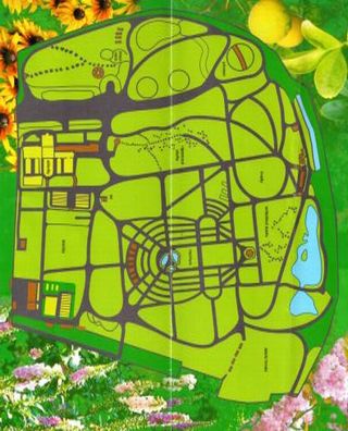
Map of Botanic Garden
GPS data available on OpenStreetMap
Send email to the editors
Your message could not be sent
but you can also reach us at webmaster-at-robotika.cz
Your message was successfully sent.
You need to turn on javascript to submit this form.

